
Precision Aerial Thermal Data
24/7
Emergency Dispatch
We deliver rapid-dispatch thermal imaging, high-resolution orthomosaic mapping, and emergency search operations across the North Alabama region with certified technical accuracy.
Thermal-equipped enterprise aircraft ready for immediate deployment.
Inspections and Thermal Search
Our enterprise drone fleet provides calibrated thermal sensors and high-resolution optical mapping for commercial property managers, real estate agents, and local families requiring immediate aerial clarity.
Thermal Search & Recovery
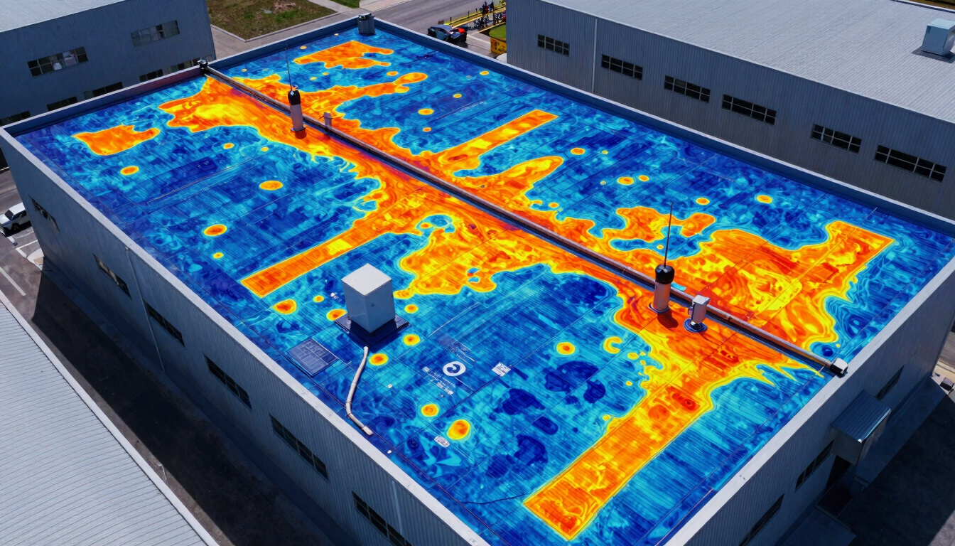
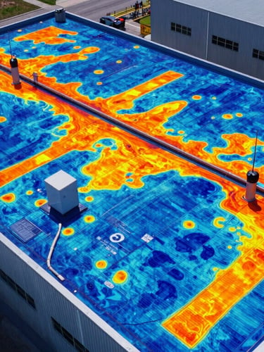
Precision Roof Inspections
Aerial Real Estate Media
Rapid-response grid search operations for missing persons and lost pets. We utilize high-sensitivity radiometric thermal sensors to detect heat signatures through dense brush and terrain night or day.
High-resolution structural analysis and thermal moisture mapping. We identify energy loss, membrane damage, and subsurface moisture entrapment on commercial and residential roofs with calibrated accuracy.
Ultra-high-resolution aerial photography and video showcasing property boundaries, architectural features, and surrounding geography to accelerate residential and commercial listings.
Certified Flight Operations
Part 107
FAA Certified Pilots
640px
Thermal Resolution
15 Min
Average Dispatch Time
Deploy Aerial Support
Contact our Huntsville-based tactical dispatch center to coordinate emergency thermal search operations or to schedule a precision structural inspection for your commercial assets.